Timberline Lake sits just under 11,000 feet (3,352 m), surrounded by a strong ridgeline and dense forest. With only 900 feet of elevation gain in just over 2 miles, this is an easily accessible opportunity to get into the backcountry and get a full Colorado mountain lake experience. The trailhead at Timberline Creek is located west of Turquoise Lake and a quick ten-minute drive from Leadville. You can access Timberline Lake, the Colorado Trail, and Bear Lake from here. The parking area is small, and Turquoise Lake Road will be lined with overflow parking on weekends and holidays.
THE FACTS:
- Elevation at lake: 10,902 feet (3322 m)
- Elevation gain: 919 feet (280 m)
- Total miles: 4.6-5 miles (7.24 km)
THE TRAIL:
I have only run this busy trail in the early morning when no one else is there yet, and let me tell you, it is one of my favorites. I used to live in Leadville and would make this a quick jaunt after an overnight shift at the hospital, and it made me feel so damn lucky to live there. Thirty minutes after I got off shift, I was running technical single track with an easy grade and taking in the sights and sounds of the Colorado backcountry. If you can experience this trail during non-peak hours, I promise you, there is something really special about this area.
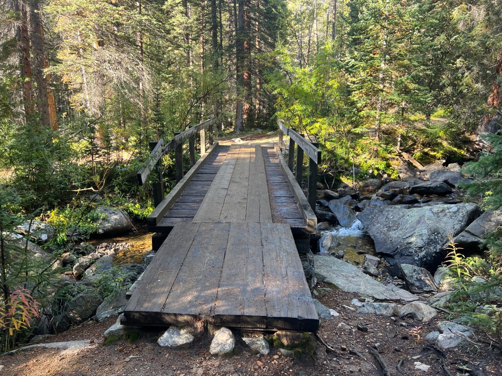
A few steps onto the trail, you come to a bridge over Timberline Creek. Be aware that this bridge is slippery in the early morning when temperatures are cold enough for frost. It was covered in invisible ice this morning, and I am still unsure how I didn’t end up on the ground after slipping and sliding my way across.
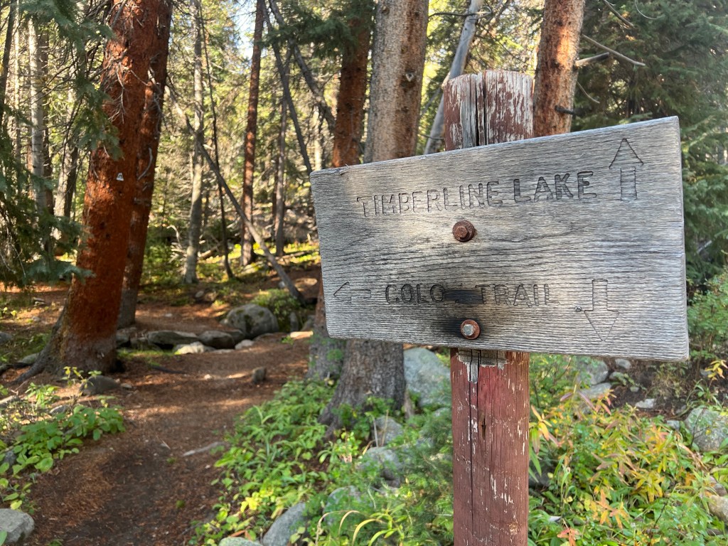
About a quarter mile from the trailhead, you come to the junction with the Colorado Trail. It is well-signed, and you will continue straight to Timberline Lake.
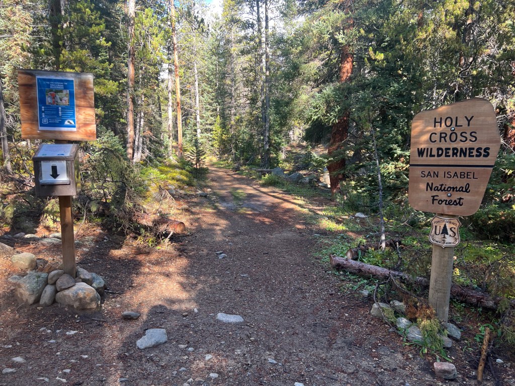
You come to the beloved wilderness boundary sign nearly a mile from the trailhead. I always love getting here because you know it’s nothing but you and the bears after this point. No motorized vehicles or anything that makes noise can enter wilderness areas, and this is as raw as the mountains get.
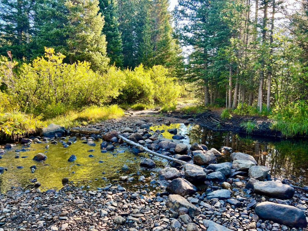
Around 2 miles, you come to a creek crossing. A boulder “bridge” helps you cross easily. In the spring, the creek will be deep and flowing fast from snowmelt and might not be safe to cross. The one time I ran this in the spring, it was waist-deep and flowing hard enough that I turned around. I was by myself, and it didn’t feel safe.
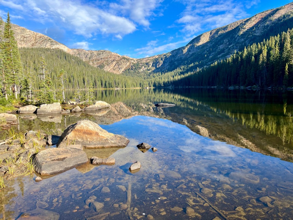
You get your first view of the southeast end of Timberline Lake, about 2.5 miles in, and it is gorgeous. Especially on a windless early morning and the water is glass. It’s tempting to take a skinny dip in the crystal clear water when you are up there by yourself. Try it.
**Bonus part of this hike: There is a singletrack trail that circumnavigates the lake. It is easy to spot and follow. 15/10 I recommend it if you have the time. I forget exactly how far it is, but if you are running and don’t stop to take a lot of pictures (hard not to), it can’t be more than an extra half hour. There are also a few camp spots on the southeast, and northwest sides.

Leave a comment