Mount Ouray is 13,971 feet (4,258 m) tall and lies at the southernmost tip of the Sawatch Range in Colorado. It is a prominent landmark for the towns of Poncha Springs and Salida to the east. There are various routes to access the summit; this trip report is for the West Ridge Route from Marshall Pass.
THE FACTS:
- Elevation at the summit: 13,971 feet (4,258 m)
- Elevation gain: 3,497 feet (1,065 m)
- Miles: 6.9 miles (11.1 km)
NEED TO KNOW: (For those who only want to know facts and not read this whole blog.)
- This entire hike is above the treeline. Do not attempt if there is any chance of thunderstorms rolling in, and you can not get a dawn patrol start to be off the mountain before noon. You will not have time to outrun a storm.
- The final push to the summit is a rock scramble along the ridge. Please always stay high on a ridge!
- There is a trail 98% of the time, with the exception of a few moments in the rock scramble. Take your time and use the trail; it will keep you and the fragile tundra safe.
THE TRAIL:
The West Ridge of Mount Ouray has been on my mind since I climbed it from the Grays Creek/East Ridge route last summer. Today’s forecast was hot with no chance of thunderstorms, and I didn’t want to drive far from home, so it was the perfect day to tackle the west side of this peak.

You don’t start down the CDT like I did. You walk east from the trailhead down Marshall Pass Road for a very short amount of time and take your first left down another road. You will see a little cabin on your left, and directly across from the cabin on the right is a single-track trail heading up toward Mt. Ouray. Take this trail.

Within a half mile, the forest begins to thin, and you start to get awesome views of Mt. KIA/MIA. The trail is well-defined and easy to follow.
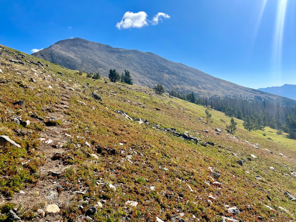
You are in the alpine tundra a little over a mile into the hike. Please stay on the trail and refrain from stomping on the fragile tundra. Ouray looks so close from here, but getting to the summit will still take a while. At this point, you will be hiking well over 12,000 feet the rest of the time, and the final summit push involves some rock hopping and navigating a ridgeline.

Once you gain the ridge, stay there! The trail becomes faint in some spots, but it’s there, and it will help you a lot when you get to the final summit push.
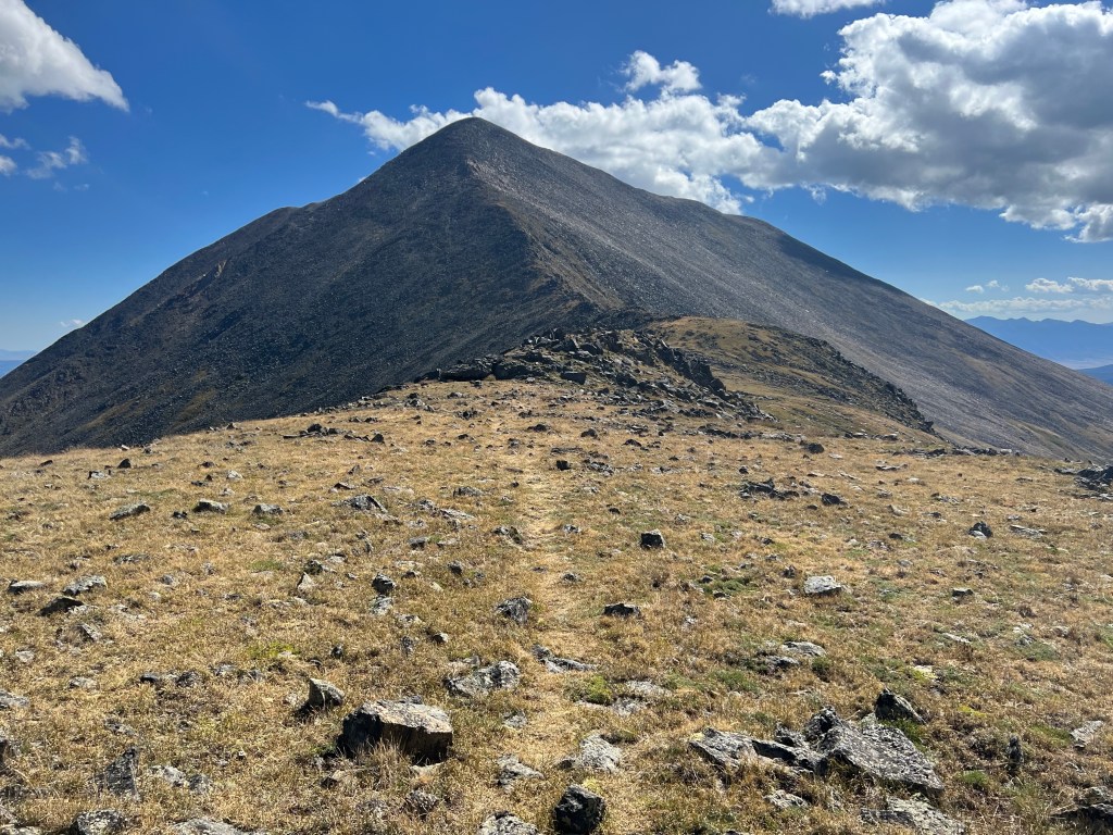
This is the last bit of tundra before you get into the boulders and a bit of scrambling and, yes, that is a false summit ahead of you, but it is not significant, and the true summit is not far at all from that point you see in the distance.
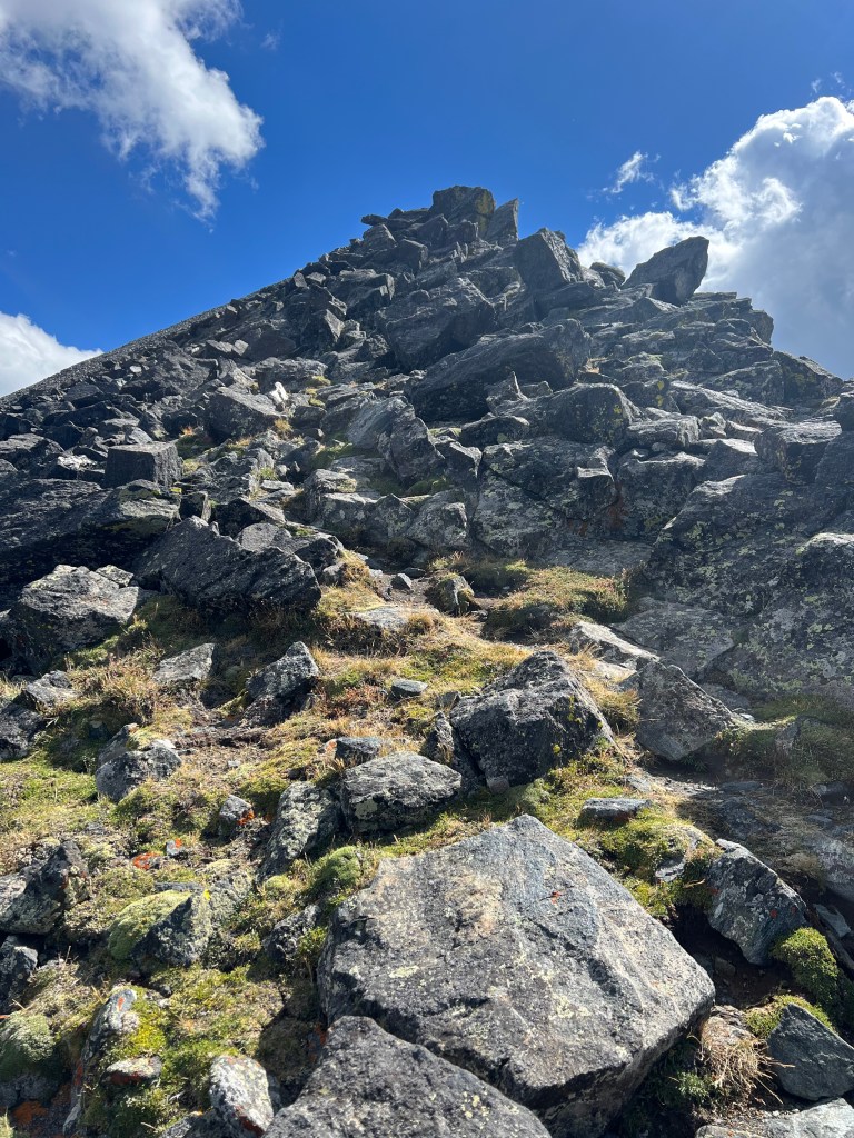
The final push to the summit is a rock scramble along the ridge. The trail does remain the entire time; you have to take it slow and look for it. Please heed this advice: always stay high on a ridge. If you lose the trail, always stay high. I know it can be tempting to go low and skirt around the ridge, but from experience, this is never a good idea. You can end up in loose, exposed terrain and possibly get cliffed out and have to turn around. Staying high and hiking on top of the ridgeline is always best.
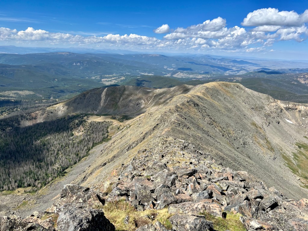
Remember to look back occasionally and check out the beautiful ridgeline you have already traversed!

This short section is unique, and the rock is white and pink. It’s beautiful. This is the only section you want to skirt around the pile on the looker’s left instead of going high. Look for the trail.

The summit of Mount Ouray is a very large flat area with a few piles of rocks used as wind barriers. Enjoy the 360 views of the Arkansas, the San Luis, and the Gunnison Valleys.

Looking southeast at the Sangre de Cristo range and down the San Luis Valley.

Looking north toward the Sawatch range.
You can turn around and head back to the trailhead from here, or if you planned it out, you could do a point-to-point and hike back down to the Gray’s Creek trailhead, which is the route I’ll have to try sometime.

Leave a comment