Megan Lake is a relatively small high-alpine lake on the east side of the Sangre de Cristo Mountains, west of the small mountain town of Westcliffe.
THE FACTS:
- Elevation of lake: 11,552 feet (3,521 m)
- Elevation gain: 2,300 feet (701 m)
- Miles: 8.34 miles (13.42 km) from the lower trailhead.
THE TRAIL:
Unlike many of the other trails in the Sangres, there are a few sections where the trail flattens out and offers some relief from the uphill grind. I chose to start about a mile from the trailhead, on North Taylor Road, after a particularly scarring experience of AllTrails directions leading me up the wrong road and getting me into a serious 4WD situation. This turned the hike into eight miles instead of the 5.4 it should have been.
You gain 1,800 feet in about 2.7 miles, so while you do get some relief on sections, this is a steep and challenging hike, just like every trail in this mountain range.
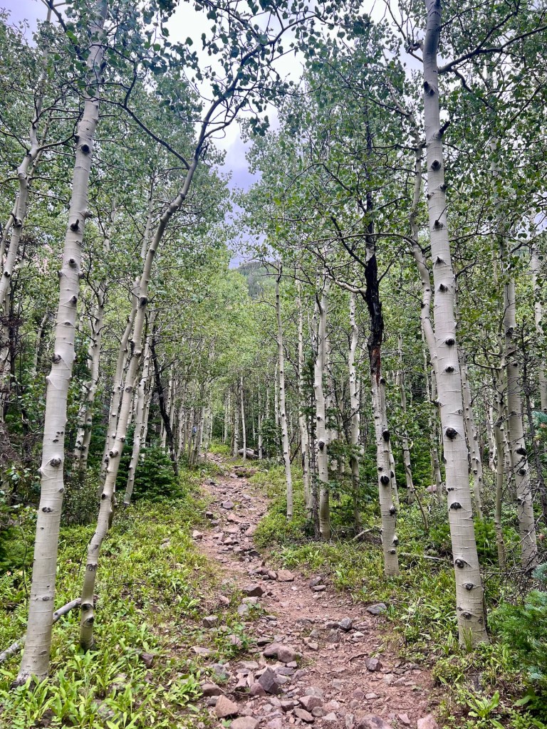
The first mile is rocky technical single track that leads you through aspen groves. The trail is in pristine shape. There is one small aspen across the trail, and it’s very easy to get over.

You will cross North Taylor Creek a few times on the hike, but none of the crossings were hard to get over in August. Be aware that these crossings could present a challenge earlier in the summer when snow is melting, and water levels are high. You will never be too far from the creek throughout the hike, and you will have access to water all summer. Bring your water filter of choice and take advantage of the cold, high-alpine water.

About 1.5 miles in, the trail pops out of the forest and into a meadow, where you get your first good views of a ridgeline that leads to Hermit and Rito Alto Peaks. This is also a nice, flat section where you can catch your breath.

After another short section of walking amongst the trees, the woods open up, and you get your first view of Megan Lake and the sub-peak of Rito Alto.
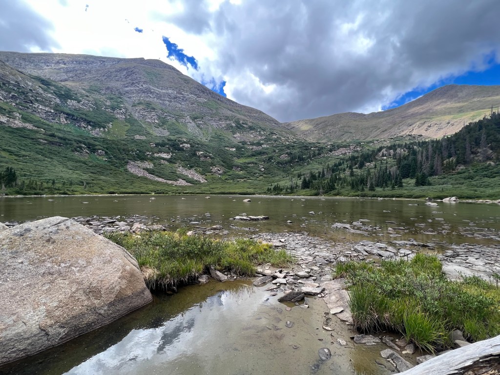
The trail will follow the east side of the lake before it peters out, and you can choose to cut down to its shores whenever you like. There is a great camp spot right off the trail with views of the lake. Despite the lake being pretty shallow, there were a ton of fish jumping, and I read that this is a popular place to fish.
GETTING THERE:
I won’t give you turn-by-turn instructions here because – Google Maps. I will use this section to talk about the things you should know that Google Maps won’t tell you. If you use the AllTrails app directions, it will take you down the wrong road, and this road is a narrow, very rough 4WD road that you don’t want to drive unless you drive for sport. You have to get to Road 173 and take it until it ends. Before it ends, there is a small sign stating who can access the road going forward, and it becomes a pretty narrow road but is manageable with a high-clearance vehicle. About 1.25 mi from the true trailhead, there are three car-size pullouts. I parked here because I was sick of driving. If you keep going to the trailhead, there is only room for one car to park, and it is also a camp spot with a fire ring.

Leave a comment